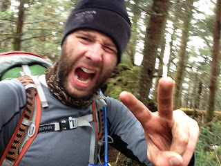
So the Norovirus, which is a stomach bug has been moving through the hiker community mostly between Hot Springs, NC and Erwin, TN. They have been warning hikers to stay away from large groups and shelters in the area. I avoided this Mountain Plague until yesterday :( maybe it was noro, maybe something else but I'm felling better so far and ready to get back on the trail.
I am uploading my photos to Flickr as well. Here is my photo stream!
http://www.flickr.com/photos/94837690@N05/
I am uploading my photos to Flickr as well. Here is my photo stream!
http://www.flickr.com/photos/94837690@N05/
Day 31, Saturday, 4/13/13, hiked 9.6 miles, Davenport Gap TN32 to Groundhog Creek Shelter mile 247.7
My cousin Kyle dropped me off at about 2pm. There was trail magic there but I had too much food already. Great day, a little hot, real pretty out with the trees budding. When I got to the shelter I met "Staff" he is from Nashville and is a U. of Kentucky fan and used to do competitive swimming. There was another guy there - I think his name is Yukon (different from the Yukon from my origonal trail family). He was reading Mere Christianity. I recall that the Church in Franklin was giving out copies. Its been a long time since I read it but definitely one of my favorites. There was also a High school group there; some school called "Outdoor Academy".
I saw vines with 3 leaves that I think were poisson ivy. I somehow I did not get any on me even though I set up my tent right next to it. I specifically looked for it before I set up my tent but I didn't see it till after I was finished setting up.
Before getting to the shelter that day I came to a cool open area - it had a white building that looked like a space ship. It was an FAA tower thing - that's the technical term (trust me i'm a doctor). I met two ladies there that drove a four wheeler to get there and then 2 locals drove up on this cool dune buggy thing and we talked for a little. I got my first view of Max Patch from that location.
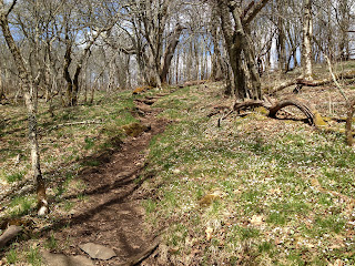
The trees are budding
FAA tower
FAA tower
You can see Max Patch on the horizon in center of picture
FAA tower
Day 32, Sunday, 4/14/13, hiked 18.7 miles, Groundhog Creek Shelter to Campsite at an old road mile 266.4
Got to Max Patch by about noon. It was a bit cloudy and windy but a great view. Match Patch is a real big patch of grass on top of a high hill/mountain. There were a lot of people there (it was Sunday afternoon) Thru-Hikers, day hikers, tourists, etc. all spread out on the patch. A nice couple and their 2 kids talked with me a while and gave me a sandwich. It was an awesome sandwich. I took it and the rest of my food and sat down on the grass to eat lunch and enjoy the view. I could have stayed there all day. Another hiker "Funny Bone" came over and took my picture for me. I saw Smiling virgin, Smokes, and Staff at the next shelter. The Germans wanted to share a room at Hot Springs. I was going to but we ended up just all tenting at the Hostel there. I camped on an old roadbed that night. When I got there my friend Matt and a few others were there. I hadn't seen Matt since the Smokies. I also met his dad there "Banter"
Max Patch
Max Patch
Tree tunnel
Day 33, Monday, 4/15/13, hiked 7.5 miles, Campsite at an old road to Hot Springs, NC mile 273.9
I got up early and made it to Hot Springs by about 10:30. You can get nice views of Hot Springs on the way down the mountain, very small but real pretty. I love walking in to a trial town. You are always walking down hill and through the trees you see houses with nice yards and fresh cut green grass (my favorite smell ever). Everything is peaceful and I see the school off in the distance and I remember my own years of captivity and how bad I just wanted to go off in the woods and explore. And then I remember that I finally have that. As a kid I wanted to be an adult so I could be free, its rare as an adult that we actually get that but I'm feeling some of that now.
When I got to town I started going the wrong way down the road and then a nice lady stopped her car and pointed me in the right direction. I didn't see them at first but there are AT emblems embedded in to the sidewalk that show the way and continue right through the center of town. I walked in to town and sat down at the first business I saw the "Smokie Mountain Diner" and had breakfast. After breakfast I walked back to the Laughing Heart Hostel, the Germans were there when I arrived. The owner was not there so I set up my tent and took a shower. It was a pretty informal place - I just came back later to pay. I went back in to town to the outfitter and got some resupply then went to the Hot Springs spa. It is down next to the river. They pump the natural hot mineral water from the area in to a hot top. It was real nice.
Hot Springs, NC
Hot Springs, NC
Day 34, Tuesday, 4/16/13, hiked 16.3 miles, Hot Springs, NC to somewhere near log cabin drive mile 290.2
I stopped in to Hiker's Ridge Ministries before leaving town. It is a nice little converted trailer with free coffee and snacks and WIFI. I met the nice lady that runs it. Her trail name is like "Pink deva" or something like that. She made some great muffins and we talked. There is a couple in the area that funds the ministry and does some other work in the community. She says the community is the poorest in NC. It was a clear day but very hot.
Hiker's Ridge Ministries
Bye bye Hot Springs
Day 35, Wednesday, 4/17/13, hiked 20.6 miles, somewhere near log cabin drive to Sugarloaf Gap (or near there) mile 310.8
Survived the lightning storms from the night before. Closest I counted was 3 seconds between the flash and the bang. It shook the ground and I could hear the sound echo through the valley around me. The rain was off and on until about mid afternoon. I stopped at a shelter for lunch because it was raining and a bit cold. I met Ryan there and a lady called "Karma". The sun came out for a while in the afternoon so I stopped at a clearing to lay out my tent to dry in the sun. Borders suggested this to me a few weeks back. It worked well my tent dried very fast and I packed up and kept going. This was my first 20 mile day!
Passed 300 miles!
Cascades
Day 36, Thursday, 4/18/13, hiked 20 miles, Sugarloaf Gap (or near there) to Spivey Gap mile 330.8
I got up early and hiked to Sam's Gap. I wanted to hitch to a diner from there but there were not a lot of cars. There was a group of hikers there that said they were sick with the "norovirus". These were the first hikers I meet that actually had it. Miss Janet came showed up to drop off a couple (and to pick up the sick hikers)- which i think included "Bean" They had been in Erwin, TN and said that the CDC and ATC (Appalachian trail conservancy) were there out of concern over this virus spreading through the hiking community. I could have asked Miss Janet for a ride to the diner but after hearing about the virus I just wanted to get out of there! Which I'm glad I did - got to Erwin quicker. I went over Big Bald that day - real pretty. Camped out at a real pretty clearing that night with a group of hikers that were nice but didn't seem to want me there for fear of the spread of this virus - so naturally I ignored there subtle clues and camped there anyways. I camped a little ways off from them and kept a respectful distance which i think they were ok with. I think one was named "mountain goat" and the group referred to themselves as "The Goat Herd". They were nice - just stand offish because of the virus. I had a toothache that night. I got up to get to Ibuprofen for it and saw the coolest site. A bright waxing moon lite up the grassy clearing and shown on the tents and highlighted the treeline. A few clouds surrounded the moon and you could see the stars - then just when I thought it the most amazing site ever there was a shooting star! My tooth felt better and I went to bed. Second 20 mile day. Back-to-back twenties!
Big Bald
Big Bald
Day 37, Friday, 4/19/13, hiked 10.7 miles, Spivey Gap to Erwin, TN mile 341.5
I got up early ~6am and packed as quick as I could, little rain over night and only a bit on the way there with mostly easy hiking. As I started up a hill off to the side was a 1 foot high stone that looked like a gravestone, someone propped it up on a tree and had written in sharpy "Here lies Norovirus". I called the Holiday Inn on my way there before getting to town. They recommended I call Miss Janet or a local shuttle driver "10-K" for a ride. I called Miss Janet when I got to the road and she said "are you the person calling me standing next to the road sign?" by this time I turned around looked down the road and sure enough I saw her van right there! Awesome! So I got in and she took me and some other hikers to the hotel, and then to pizza hut and then to Walmart! which is great because nothing in Erwin is within an easy walking distance. In the van I saw Bean again and I met "cyclops" and "Waffles". We dropped by another Hotel to pick up some others too- turns out it was the group of sick hikers I met at Sam's Gap the previous day. I was nervous about being in the same van as them, I had been avoiding shelters and large groups since Hot Springs to steer clear of the sickness and now I was in a van full of sick hikers! Oh well, I lived.
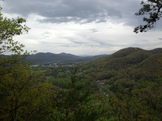
View of Erwin, TN
Day 38, Saturday, 4/20/13, hiked 17.5 miles, Erwin, TN to Cherry Gap Shelter mile 359.0
Leaving Erwin
Leaving Erwin
Beauty Spot Gap
Beauty Spot Gap
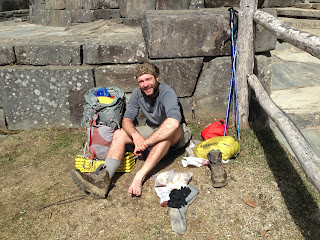
Me on Beauty Spot Gap
Spruce Forest on Unaka Mountain
Met "Shrek" he had a problem with his toe and wanted to know if it was infected - In my proffesional oppinion (I am a docotor) it was fine. Really I'm last last person who should be consulted about such things - I don't know anything about anything. I also met a section hiker that informed myself and "bulldog" about Wild Mountain Onions or Ramps that grow in the area and are edible.
Shrek was at Hugh's Gap when I got there, it meets at a small road. He had all his food spread out in front of him - 3 cracker packets - he needed to get to a town. The second car that came by stopped for him, amazing! A nice couple pops out, they have done some hiking before and like to help hikers, I think they were Christians. They gave me a rootbeer and Reese's peanut butter cups! Then they took Shrek to town and even brought him back.
I really enjoyed my root beer but I was bummed when I finished it. Then I remembered the Resses in my pocket! I ate it and sang "its the greatest day!" - a song with one line which I wrote right there.
Day 40, Monday, 4/22/13, hiked 15.4 miles, Roan High Knob Shelter to the former site of Apple house shelter mile 391.2
It was a cold night (I was above 6,000 feet) and the water in my water bladder was half frozen my morning. Bulldog, Bamboo, and Morning Kid came up to see the shelter (it is the highest on the AT). I also saw Shaman and Dino DNA again. I went over to see Overmountain shelter half way through the day - it is an old barn that was converted into a shelter. It is named after the "Overmountain men" who hiked through that valley to fight and defeat the British lead loyalists in Revolutionary times (I read the sign near the trail). I hiked up Hump Mountain which is a very big bald mountain, lots of grass and real pretty.
Overmountain Shelter
Overmountain Shelter

Hump Mountain

Was pretty much walking the TN/NC line and back and forth over the line but now I finally made it all the way out of NC
Day 41, Tuesday, 4/23/13, hiked 19 miles, former site of apple house shelter to Moreland Gap Shelter mile 410.2
Saw a cool waterfall. Mid afternoon I realized I was close to a Hostel. It was about 0.3 miles off the trail. I went down and met the owner "Scotty". I told him my trail name was Steady-State and he immediately knew what it meant and determined I was an Engineer. Turns out he is also and Electrical Engineer. I stepped inside and indeed all the signs were there: ham radio, calculus books, solder-less breadboard. I got some pop, ice cream, a snickers and a shower there. I also met his really friendly, really fluffy dog! I sat down to eat my ice cream and he took a break from working on this deck, grabbed his ice cream and came over to talk with me. He has hiked the AT 3 times! I guess he is off and on as far as Engineering work. Cool guy, he grew up in the area and is running the Hostel for now but will return to Engineering again soon.
Passed the 400 mile mark!
Waterfall
A fluffy dog at the hostel
A fluffy dog at the hostel
Day 42, Wednesday, 4/24/13, hiked 8.7 miles, Moreland Gap Shelter to side trail that goes to Hampton, TN mile 419.2
Got up early to hike in to Hampton to beat a storm that didn't come till much later in the afternoon than expected and wasn't much of anything. Really pretty walk along the creeks and around Laurel Falls. Lots of rock cliffs, gorges etc. There was also a cool rock ledge where the trail was about 2 feet wide with the river on one side and the rock face on the other.
Laurel Falls
I took the one mile side trail in to town and went to the laundromat - the laundromat that also sells burgers, bikes, computers and does tech support. I made an appointment with a Dentist in Hickory from the trail. I had a burger at the luandromat, ice cream at the groscery store next door then I hiked all the way through town to the McDonalds for more ice cream! and then back to the laundromat to wait for my friend Sam to pick me up. The town has 2 Baptist Churchs almost right next to each other! In town I saw Shrek, Morning kid, Funny Bone and a couple I met the previous night. I met a man at McDonald's that said his family used to own part of the Hump Mountain area and he had fond memories of coon hunting there when he was younger. By the way: these people I meet and talk to - I don't normally do this! I met other hikers because we have an instant comradery due to the trail and I talk to people in towns either because the locals enjoy talking to homeless smelly people like me or maybe its that small town friendliness.
I talked to Funny Bone (guy I met at Max Patch) and he gave me some advice about my foot which had been hurting a bit. Turns out he has hiked the PCT (Pacific Crest Trail) as he says "a couple times" and is a trainer for rowers and endurance athletes.
Funny Bone's advice:
- Take a 5-10 minute break at least about every 2.5 hours
- Don't take Ibuprofen as a long term solution
- Take a 1-2 hour break around noon and soak your feet in a cold stream
- Maybe sleep with your feet slightly elevated at night to drain the inflamation
- If something is hurting take a half day off from hiking
My friend Sam picked me up, he had his son Mitch with him. I used stay at Sam's house when he lived in Corning/Elmira, NY and was best man at his wedding. Last time I saw him and his wife Kelly was at their wedding about 5 years ago. They have two kids now and live in Hickory, NC. They are really great people! Sam took me to a BBQ place on the way back to his house. We also stopped at Mast General store in Boone to get new trekking poles. Real nice of them to let me stay a few days and to drive 2 hours (one way) to get me!
Day 43, Thursday, 4/25/13, hiked 0 miles, Hickory, NC
Went to the Dentist - Dr. Powell. The staff saw I was from San Antonio and asked "How did you get here?" So I said "I hiked here!" and then they wanted to know all about my trip. The Doc and assistant checked my teeth but I really didn't feel any pain. The short of it is that they say I grind my teeth at night a lot and my teeth are warn down. I need a bit of work and a custom night guard but the doc said I can put it off until my trip is done and just get one of those cheap drug store night guards for now. It isn't great news, but not so bad really, its been a while nice I have been to a dentist so I was glad they didn't say "you have cavities, you are a poor brusher and a terrible person" which is what dentist like telling me. So no big deal just $40 for the visit and another $30 for a night guard and I will take care of the rest when I get back.
Day 44, Friday, 4/26/13, hiked 0 miles, Hickory, NC
Worked on my blog and went to a farmers market Sam and Family.
Day 45, Saturday, 4/27/13, hiked 0 miles, Hickory, NC
Worked on my blog.
Day 46, Sunday, 4/28/13, hiked 0 miles, Hickory, NC
Was sick :( but felling better now.
Day 44, Friday, 4/26/13, hiked 0 miles, Hickory, NC
Worked on my blog and went to a farmers market Sam and Family.
Day 45, Saturday, 4/27/13, hiked 0 miles, Hickory, NC
Worked on my blog.
Day 46, Sunday, 4/28/13, hiked 0 miles, Hickory, NC
Was sick :( but felling better now.
Sam, Kelly and Family! It was great to see them again and they were very kind, taking care of me and letting me stay so long!


